
Las Vegas braces for rare October flooding and strong winds as Tropical Storm Rachel’s remnants trigger weather alerts and threaten travel disruptions across the valley.
By Friday afternoon, the National Weather Service had Las Vegas on edge. The city, usually bone-dry in October, now faces a sudden threat from the remnants of Tropical Storm Rachel. Flood Watch and Wind Advisory alerts landed across the valley, with warnings that flood channels could overflow and travel could grind to a halt. The flood watch runs from 11:00 PDT on October 10 to 05:00 PDT on October 12, 2026. The wind advisory kicks in at 05:00 PDT on October 11 and lasts until 05:00 PDT the next day.
The NWS flood watch zone includes not only the Las Vegas Valley but also northeast, south, and west Clark County, the Spring Mountains, southern Nye County, Lake Mead and Lake Mohave areas, Sheep Range, and Lincoln County.
Severe Weather Threatens Valley Infrastructure
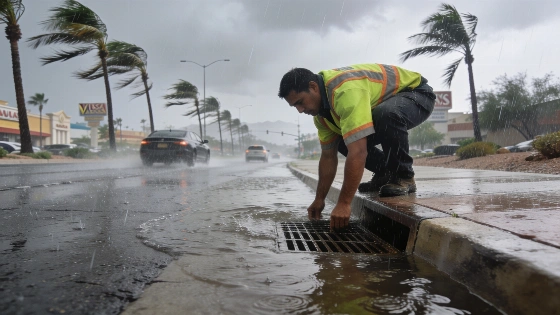
The Clark County Regional Flood Control District has already put detention basins on storm standby. Crews cleared out major wash channels and culverts along the Flamingo, Tropicana, and Las Vegas Wash corridors. The National Weather Service says a plume of tropical moisture, pulled north by a Pacific trough, will clash with cooler desert air. That sets the stage for scattered severe thunderstorms and bursts of heavy rain. Some neighborhoods could see over an inch of rain in a short window, leaving standing water on main roads like Sahara Avenue, Decatur Boulevard, and underpasses along the resort corridor.
For parts of southern Nevada, northwest Arizona, and southeast California, wind gusts of 45–55 mph are forecast, with the NWS warning of possible downed tree limbs and power outages.
Travel and Power Disruptions Expected
High-profile vehicles face a tough drive, especially on northbound I-15 toward Utah and US-95 toward Nye County. Blowing dust could cut visibility on open stretches. NV Energy has crews on standby for downed limbs and scattered outages. Temperatures will drop sharply, with highs falling from near 100°F to the low 80s and upper 70s by Sunday and Monday.
Travelers could see ground-stops at Harry Reid International Airport if crosswinds disrupt flight schedules. Flash flooding and gale-force gusts threaten to delay flights and make driving dangerous across the valley.
Unusual October Pattern for Southern Nevada
October rarely brings this kind of weather to Southern Nevada. The National Weather Service’s Las Vegas Forecast Office, as reported by the Las Vegas Review-Journal and Las Vegas Sun, points out how unusual this system is. The last time a tropical threat hit the region, local infrastructure and travel took a hit.
The Clark County Regional Flood Control District remains on alert, and utility crews are prepping for outages. The city’s response will be measured by how it handles this rare October storm. The collision of tropical moisture and desert air shows that Las Vegas, despite its engineered defenses, can still get caught off guard by sudden weather swings. The official NWS forecast pins the threat on Rachel's remnants, which are set to bring heavy rain and gusty winds to the Southwest U.S. from October 10 to 12.